What is photogrammetry? One geospatial specialist explains how photos can create 3D models

TL:DR: 3D models are very useful for understanding physical space. Using digital photogrammetry, photographs can be stitched together to create an accurate digital replica of a real-world structure or location. Mr Quek Junjie, associate geospatial specialist at GovTech’s Geospatial Specialist Office, shares his insights on the technology.
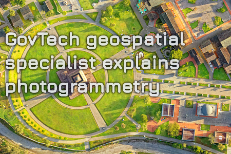
If a picture paints a thousand words, then a three-dimensional (3D) model of an object or space is bound to tell an even more compelling story. Using software to stitch together photographs of a location taken from different angles, Mr Quek Junjie, associate geospatial specialist at the Government Technology Agency of Singapore (GovTech), can construct virtual 3D models of actual places—a technique known as digital photogrammetry.

In this interview with TechNews, he shared how government agencies can tap on photogrammetry to manage and plan urban spaces.
What is digital photogrammetry and how is it useful?
Put simply, digital photogrammetry is a workflow to convert photographs or videos of a physical space into a virtual 3D model that can be measured and manipulated. Your input data is photographs, and depending on the equipment used to obtain those photographs, your virtual 3D model will vary in terms of detail and accuracy.
For example, if you use a smartphone camera to take comparatively lower-resolution photos, then your resultant virtual 3D model will be less accurate, but it can be built in a short amount of time.
On the other hand, if you use a DSLR camera, the level of detail and information per photograph is greater, so the model will be more accurate, although it could take longer to generate. This is just the ‘photo’ part of the term ‘photogrammetry’. The other part of the word has to do with measurements.
Once you have a virtual 3D model that preserves information about the scale and proportions of an area, you can perform calculations of not just length or distance, but also area and volume. For instance, after you have excavated a landfill, a lot of soil needs to be moved off site. In the past, you would get a quote from a tipper truck vendor who would estimate the number of trucks required for that operation.
With digital photogrammetry, you could use a drone to map out the landfill and land pile in detail, then use the virtual 3D model to calculate the volume of soil that needs to be moved. This will help you derive a precise number of tipper trucks to hire. In this case, since there is no guesswork involved, digital photogrammetry can result in the more effective deployment of resources, and potential cost savings.
You mentioned that photos from smartphones can be used in digital photogrammetry. Can citizens help map certain areas in Singapore?
I think it will be quite challenging to achieve a crowdsourcing-type model for digital photogrammetry work. This is because you need some domain expertise to carry out the entire process properly. For example, you need to take the photos in a structural, ordered way—what is known as the structure from motion (SfM) method. Sometimes, drones may be used, which means that you need a license to operate the drone, and the flight path must be planned in a specific way.
Also, because citizens use different kinds of smartphones, cameras and settings, the software we use may have difficulty stitching the images together into a virtual 3D model. So I think crowdsourcing digital photogrammetry work is not very feasible at the moment.
Could you tell us about a project within the government that involves digital photogrammetry?
We recently collaborated with the Land Transport Authority (LTA) where we carried out two POCs, including a three-day workshop during which we walked LTA officers through the entire process of using digital photogrammetry, from selecting the right camera to eventually building the virtual 3D model.
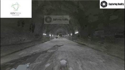
What LTA wanted to do was to explore mapping their construction sites both above ground and underground i.e. train tunnels using digital photogrammetry. Currently, for tunnel scanning, LTA is trialling a laser-based method that is accurate to millimetres, but the technique is more time-consuming.
At the end of the POCs with LTA, we were able to generate a virtual 3D model of the tunnel using digital photogrammetry, albeit at a lower resolution than the laser-based technique.
One point to note is that additional lighting provision was required in the tunnel environment to ensure good quality photos could be captured for the digital photogrammetry process.

Based on this experience, LTA continued to explore using digital photogrammetry as a functional tool for quick visualization. For example, it can be use to create a quick virtual 3D model of structures above ground.
What are some of the challenges you face in your role as a geospatial specialist?
As a geospatial specialist, one of my key roles is to be an advocate for useful technology dealing with locational data and 3D spaces, such as digital photogrammetry. For the last one to two years, my team has been studying the full spectrum of devices and processes associated with digital photogrammetry, so we can now advise other agencies on what they can do with the technology and the best practices surrounding it.
I would say that the challenges I encounter stem from limitations of the technology itself. Digital photogrammetry does not work very well for indoor spaces with featureless walls and glass panels. To stitch together multiple images and create the virtual 3D model, there needs to be a way for the software to orientate each image with reference to another photo, so if it’s just a large featureless or transparent space, the lack of a clear reference point can prevent the construction of a good virtual 3D model.
Going forward, what are some of your team’s goals?
We will continue to help other government agencies understand the utility of digital photogrammetry and identify relevant use cases for the technology. For every geospatial mapping project, there is a need to strike a balance between cost and delivery time, so digital photogrammetry could be a viable option in certain contexts.
Moreover, we should keep in mind that digital photogrammetry need not be used in isolation. It could complement other techniques, such as laser mapping. Although laser mapping can produce a high-resolution virtual 3D model, lasers don’t reproduce colours, but if you add in the pixels from the images captured for digital photogrammetry, you will then be able to recreate a true to life model of 3D space.
I want to emphasise that digital photogrammetry is not an endpoint—it provides you with a 3D environment to make measurements, overlay information and plan for future work on a physical space.
https://www.tech.gov.sg/media/technews/what-is-photogrammetry-one-geospatial-specialist-explains-how-photos-can-create-3D-models
