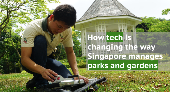
How tech is changing the way Singapore manages parks and gardens

Find out how technology is changing the way parks and gardens are maintained and start learning more about our green spaces through mobile apps.
With a global reputation for being a biophilic City in a Garden, Singapore goes to great lengths to balance nature and rapid urbanisation. Built-up as the city state may be, it boasts more than 3,347 hectares of nature reserves, six million trees, and more than 350 parks and gardens scattered across the island.
The National Parks Board (NParks), a statutory board of the Government of Singapore, is responsible for maintaining and growing these natural spaces over the years. Going beyond simply setting aside areas for the conservation of flora and fauna, NParks seeks to integrate greenery into urban landscapes, building on a vision to transform Singapore into a biophilic city.
“Biophilic means that people and nature are always in close proximity. In the past, buildings were buildings, and parks were parks. That line is increasingly being blurred as we continue our efforts to green our city,” said Mr Shee Zhi Qiang, director, horticulture and operations at the Singapore Botanic Gardens.
Technology is critical in NParks’ mission, and TechNews found out how digitalisation, data and even drones are helping to protect and promote nature in Singapore.
INSPECTION & MAINTENANCE
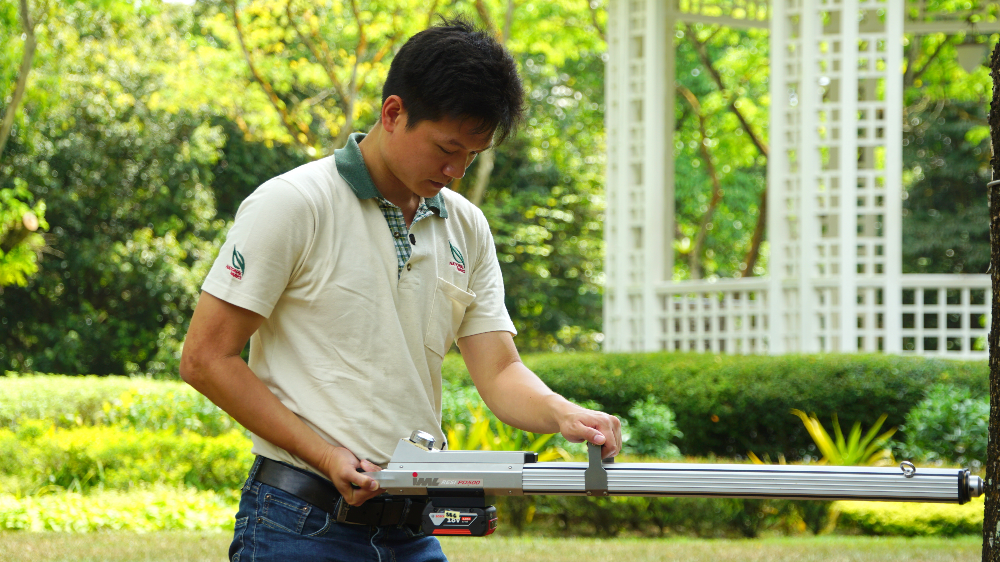
Resistograph
One of the tallest trees in the Singapore Botanic Gardens—the Jelawi tree (Terminalia subspathulata King)—stands at 47 metres and is more than 150 years old! While plants are regarded as potentially immortal, they can be infected by pests and diseases that may compromise their structural integrity.
“One tool that we’ve been using to detect decay in trees is called the resistograph. This is a machine that drills into the tree and measures the resistance of the wood,” said Mr Shee. By comparing the measured resistance profile to a reference profile for the species of tree, NParks officers can determine whether a tree is structurally sound.

Drones
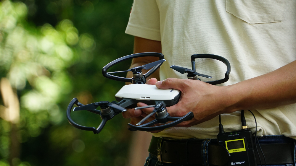
To carry out tree inspections, arborists may have to climb to great heights. While many officers may enjoy this aspect of their job, it is time-consuming and comes with its inherent risks. Instead, NParks is now deploying aerial drones equipped with digital cameras to assess even the uppermost branches of trees.
The tree inspection microdrone, developed in collaboration with the Singapore University of Technology and Design, is providing NParks with live video streams for officers to evaluate tree health. This serves as a first step to in the tree inspection regime. NParks is also working with the Civil Aviation Authority of Singapore and other government agencies to explore the use of drones for monitoring forest fires.

Robotic grass mower
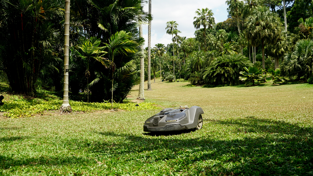
The sprawling lawns in many of Singapore’s parks and gardens require trimming on a regular basis. Helping to reduce the reliance on manpower for this laborious task are the robotic grass mowers that automatically make their rounds daily—like Roombas, but with blades.
“We have 15 of these robots deployed in the Singapore Botanic Gardens itself. They cut the grass silently every night while we sleep, leaving the lawns free for public to enjoy during the day. An added benefit is that we don’t have to clear up the grass clippings because the amount being trimmed every day is kept minimal,” explained Mr Shee.

DATABASE & ANALYTICS
Mobile field app
In the past, NParks officers keyed in their field observations and data into devices that were not connected to the internet, which meant that it had to be docked back at the office before information could be transferred and analysed.
“Now, our officers use a mobile field app on a tablet and the data is automatically updated to our own internal database. Since most people are familiar with using tablets and other mobile devices, there was very minimal training required to adopt the new system,” said Shee.
MAVEN
With more diverse data sources and greater data complexity, the integration of data sets will allow NParks to obtain deeper insights about Singapore’s green spaces. This is made possible by MAVEN, a common geospatial information system co-developed by the Government Technology Agency of Singapore (GovTech) allowing data from satellites, field operations, public feedback, and flora and fauna sightings to be overlaid on a map of Singapore.
“Data gathered by external agencies like the Urban Redevelopment Authority or Land Transport Authority is also included, thereby facilitating inter-agency planning,” Mr Shee noted.
Modelling
If the resolution of data is high enough, NParks officers can even create models and run simulations of individual trees. For example, using Light Detection And Ranging (LiDAR) scan of a tree, officers can generate a model to predict tree behaviour under different weather conditions. Such models could be immensely useful when scheduling tree pruning and other garden or park maintenance activities.
NATURE CONSERVATION & CITIZEN SCIENCE
Camera traps
Animals and birds are part of Singapore’s natural ecosystems. By tracking their populations and movements in the wild, conservation efforts can be adapted accordingly. Camera traps are therefore an indispensable part of wildlife monitoring as they provide information about how wildlife use their native environment, which would not be available through other means.
“For instance, we can use camera traps to learn how the animals are using the eco-links over the highway roads to cross over to the other side safely,” said Mr Shee.
Underwater drones and sensors
The sea surrounding Singapore is rich in biodiversity, and NParks plays an important role in managing our coastal and marine areas. Mr Shee highlighted that underwater drones are being used to investigate dugong feeding trails, while underwater sensors are gathering data on oceanic circulation and coral dispersal.
SGBioAtlas
Caring for nature cannot be left to the authorities alone. Hence, NParks is using mobile apps to educate citizens about nature and get them involved in conservation efforts. The SGBioAtlas app, free to download from the App Store or Google Play Store, allows citizens to take photos of flora and fauna around Singapore and submit those images to NParks for identification.
“This is a win-win situation because not only do citizens learn about the organisms sharing their environment, but at the same time, NParks gathers data about the location and frequency of interesting sightings,” Mr Shee explained.
trees.sg
Finally, nature lovers can also visit trees.sg to find out the scientific and common names of trees planted in their neighbourhoods, as well as details about the dimensions, carbon content, pruning schedules of each tree. Developed together with GovTech, the trees.sg database contains data on more than 500,000 urban trees and is synchronised with MAVEN, making it easy for both the public and NParks officers to access up-to-date information.
https://www.tech.gov.sg/media/technews/how-tech-is-changing-the-way-singapore-manages-parks-and-gardens
